Project Background
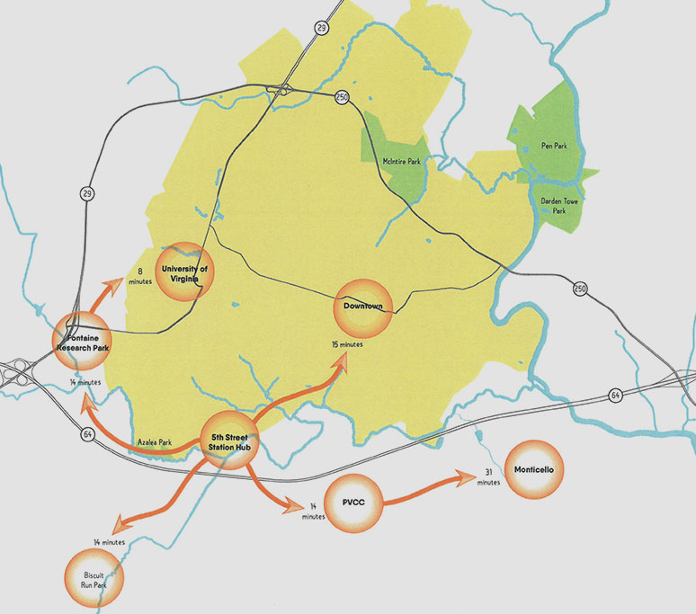
Location: This project is located at the hub of a system of existing and proposed bicycle/multi-use trails in Charlottesville/Albemarle. New trails near 5th Street Station will connect 5th Street Extended to neighborhoods to the south of I-64. This area is central to a network of walking and bicycle facilities for the City of Charlottesville and Albemarle County and will link multiple neighborhoods and resources in both localities.
Funding: Project funding was awarded through the Virginia Department of Transportation (VDOT) as a federal grant as part of the Transportation Alternatives Program (TAP) in the amount of $399,880. Albemarle County has provided $200,000 of local funds, which were part of the proffer for the 5th Street Station development, for a total of $599,880 for design and construction of the trails.
Project Scope and Design Development
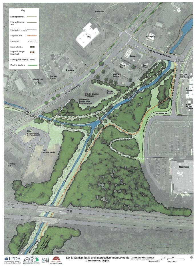
Trail Route: A proposed route was presented at a public meeting held March 15, 2018, based on input from stakeholders received through a series of meetings. Design consultant Land Planning and Design Associates (LPDA) then prepared a preliminary design package based on that layout, which was completed in June 2018. The height of the bridge and design of the new trails avoided any additional displacement of water in the Moore’s Creek floodway. This required raising the bridge over Moore’s Creek and utilizing boardwalk up to the bridge and also through the wetlands up to the intersection of Fifth Street Station Parkway and including work at that intersection for bike and pedestrian access. The cost estimate for this layout greatly exceeded available funds at $2.8 million.
Revised Route: The team adjusted the project scope to eliminate the bridge over Moores Creek for this project, and allowing displacement in the floodway and floodplain. Some boardwalk would still be leading up the intersection, which would need to be improved to provide bike and pedestrian access. This reduced the estimated costs to $1.07 million, still exceeding currently available funds. The team plans to apply for additional TA funding in 2019.
Study Area Map
Project Timeline
November 2015 | TAP application submitted to VDOT
June 2016 | Commonwealth Transportation Board approves application for funding
December 2016 | Federal Authorization and contract in place
January 2017 | Request for Proposal issued for design consultant
February 2017 | Expression of interest received from 4 firms
March 2017 | Interview with short-listed firms
November 2017 | Contract in place with Land Planning & Design Associates (LPDA) for design work
January 2018 | Stakeholder meetings with homeowner associations and businesses
March 2018 | Public meeting to present conceptual layout based on stakeholder input
February 2019 | 50% design submitted to VDOT for review
September 2019 | Final Plans submitted to VDOT
October 2019 | Apply for additional TAP funding
June 2020 | Anticipated award of additional funding
November 2020 | Amended contract in place for additional funding
February 2021 | Construction bids received
October 2021 | Construction Complete